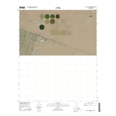
2014 Map of South of Somerton
USGS Topo · Published 2014About this map
The international border between the United States of America and Mexico bisects this portion of Yuma County, documenting the urban expansion of San Luis in the early 21st century. The map illustrates a strict grid system typical of border communities, where residential streets like E San Pedro St and E Aracely St terminate near the desert landscape. To the east, the terrain remains largely undeveloped, defined by Township 11 South and Ranges 23 and 24 West. Notable thoroughfares such as E Juan Sanchez Blvd and the descriptive Border Rd provide the primary east-west connectivity through this arid region of Arizona. The map serves as a record of the precise geographic boundary line and the infrastructure supporting this crossing point, capturing the contrast between dense residential planning and the open desert of the Yuma vicinity.
Find a feature on this map
23 named features on this map. Tap any name to fly to it.
Don’t see what you’re looking for? This feature index may not catch every label — zoom into the map to look around manually.
Map Details
Editions of this 2014 South of Somerton Map
This is the sole edition of this map. No revisions or reprints were ever made.
Other maps of this area

1903 · Yuma
USGS Topo · 1:125,000

1905 · Yuma
USGS Topo · 1:125,000

1940 · Yuma
USGS Topo · 1:62,500

1942 · Yuma
USGS Topo · 1:250,000

1945 · Yuma
USGS Topo · 1:62,500

1954 · El Centro
USGS Topo · 1:250,000

1955 · El Centro
USGS Topo · 1:250,000

1958 · El Centro
USGS Topo · 1:250,000

1961 · El Centro
USGS Topo · 1:250,000

1964 · El Centro
USGS Topo · 1:250,000