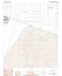
1990 Map of South of Somerton
USGS Topo · Published 1991About this map
San Luis Rio Colorado straddles the international boundary in this 1990 survey, marking the transition from the arid Yuma Desert into the northern reaches of the Desierto de Altar. The map illustrates a landscape shaped by binational agricultural and infrastructure projects, featuring the expansive irrigation networks of the Distrito de Riego Numero Catorce and an Aqueduct system. On the American side, the isolated Yuma Medium Security Facility (State Prison) stands near a series of sewage disposal ponds, reflecting the logistical needs of this border corridor. Sparse 4wd trails crisscross the desert floor, leading to scattered features like a Sub Station, a small cemetery, and the settlement of Las Adelitas just south of the border. This map provides a clear view of the borderlands during a period of steady growth and infrastructure development.
Find a feature on this map
19 named features on this map. Tap any name to fly to it.
Don’t see what you’re looking for? This feature index may not catch every label — zoom into the map to look around manually.
Map Details
Editions of this 1990 South of Somerton Map
This is the sole edition of this map. No revisions or reprints were ever made.
Other maps of this area

1903 · Yuma
USGS Topo · 1:125,000

1905 · Yuma
USGS Topo · 1:125,000

1940 · Yuma
USGS Topo · 1:62,500

1942 · Yuma
USGS Topo · 1:250,000

1945 · Yuma
USGS Topo · 1:62,500

1954 · El Centro
USGS Topo · 1:250,000

1955 · El Centro
USGS Topo · 1:250,000

1958 · El Centro
USGS Topo · 1:250,000

1961 · El Centro
USGS Topo · 1:250,000

1964 · El Centro
USGS Topo · 1:250,000