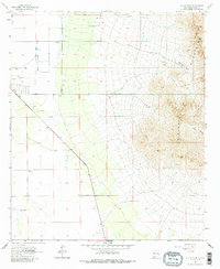
1965 Map of South Peak
USGS Topo · Published 1986About this map
The Florida Mountains dominate the eastern landscape of this Luna County region, rising sharply above the desert floor to the heights of South Peak. This mid-century survey captures a transitional ranching and extraction environment, where isolated landmarks like the Crawford Ranch and the McBee Windmill provide critical water and habitation in an arid expanse. The western portion of the map is defined by a systematic grid of section lines and numerous water resources, including Palayo Tank and various named wells like Well 4216, illustrating the infrastructure required for livestock in the high desert.
Find a feature on this map
21 named features on this map. Tap any name to fly to it.
Don’t see what you’re looking for? This feature index may not catch every label — zoom into the map to look around manually.
Map Details
Editions of this 1965 South Peak Map
2 editions found

Other maps of this area

1899 · Deming
USGS Topo · 1:125,000

1915 · Deming
USGS Topo · 1:125,000

1917 · Hermanas
USGS Topo · 1:62,500

1917 · Columbus
USGS Topo · 1:62,500

1918 · Columbus
USGS Topo · 1:62,500

1918 · Hermanas
USGS Topo · 1:62,500

1920 · Columbus
USGS Topo · 1:62,500

1943 · Hermanas
USGS Topo · 1:62,500

1953 · El Paso
USGS Topo · 1:250,000

1955 · Las Cruces
USGS Topo · 1:250,000