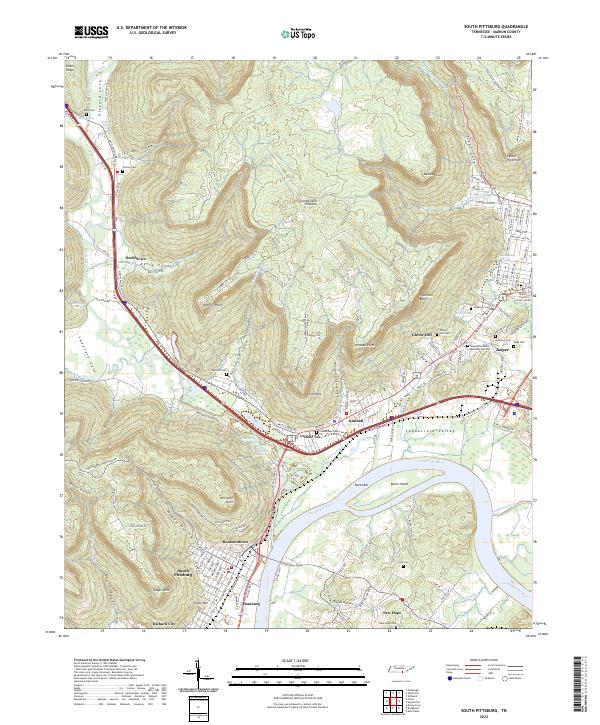
2022 Map of South Pittsburg
USGS Topo · Published 2022About this map
The Tennessee River and Sequatchie River converge in this corner of Marion County, where the industrial and residential corridors of South Pittsburg and Jasper are defined by the surrounding plateaus. The landscape is a complex network of coves and points, with Cumberland Plateau rising sharply above settlements like Raulstontown and Hamburg. The map documents a dense concentration of local communities, from Richard City in the south to the small clusters at Smithtown and Dixie Lee along the base of the ridges.
Find a feature on this map
149 named features on this map. Tap any name to fly to it.
Don’t see what you’re looking for? This feature index may not catch every label — zoom into the map to look around manually.
Map Details
Editions of this 2022 South Pittsburg Map
This is the sole edition of this map. No revisions or reprints were ever made.
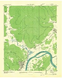
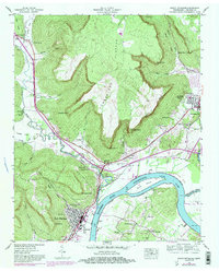
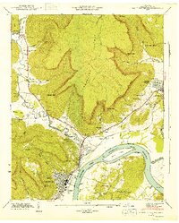
Historical Maps of Kimball Through Time
4 maps found