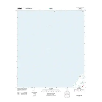
2012 Map of South Point
USGS Topo · Published 2012About this map
Lake Pontchartrain dominates this coastal landscape, revealing the transition between the open waters of the lake and the marshy southeastern shores of Orleans Parish. The map centers on the Big Point Gas Field, illustrating the industrial footprint within the lake itself. Along the shoreline, the small settlement of South Point sits at the nexus of several vital waterways, including the Little Woods Canal and Cane Bayou.
Find a feature on this map
10 named features on this map. Tap any name to fly to it.
Don’t see what you’re looking for? This feature index may not catch every label — zoom into the map to look around manually.
Map Details
Editions of this 2012 South Point Map
This is the sole edition of this map. No revisions or reprints were ever made.
Other maps of this area

1891 · Spanish Fort
USGS Topo · 1:62,500

1892 · Chef Menteur
USGS Topo · 1:62,500

1935 · Slidell
USGS Topo · 1:62,500

1935 · Covington
USGS Topo · 1:62,500

1936 · North Shore
USGS Topo · 1:31,680

1936 · South Point
USGS Topo · 1:31,680

1936 · Chef Menteur
USGS Topo · 1:62,500

1936 · Spanish Fort
USGS Topo · 1:62,500

1937 · Chef Menteur
USGS Topo · 1:31,680

1938 · Little Woods
USGS Topo · 1:31,680