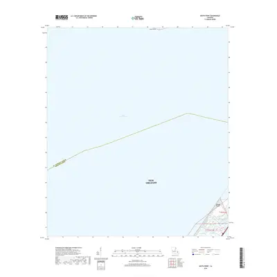
2018 Map of South Point
USGS Topo · Published 2018About this map
Lake Pontchartrain dominates this 2018 survey, which documents the shoreline and waterways where the limits of New Orleans meet the open water. The map traces the jurisdictional boundary between St. Tammany Parish and Orleans Parish, following a precise line across the lake's surface. Along the southeastern shoreline, the small settlement of South Point stands at the edge of the wetlands, served by local water management infrastructure like the Little Woods Canal. This map provides a clear record of the coastal interface, marking where tidal inlets like Cane Bayou and Bayou Castiglione drain into the lake. The inclusion of Point Platte in the north and the deep-water expanses of the lake illustrate the environmental character of this specific reach of the Louisiana coast just before the end of the decade.
Find a feature on this map
10 named features on this map. Tap any name to fly to it.
Don’t see what you’re looking for? This feature index may not catch every label — zoom into the map to look around manually.
Map Details
Editions of this 2018 South Point Map
This is the sole edition of this map. No revisions or reprints were ever made.
Other maps of this area

1891 · Spanish Fort
USGS Topo · 1:62,500

1892 · Chef Menteur
USGS Topo · 1:62,500

1935 · Slidell
USGS Topo · 1:62,500

1935 · Covington
USGS Topo · 1:62,500

1936 · North Shore
USGS Topo · 1:31,680

1936 · South Point
USGS Topo · 1:31,680

1936 · Chef Menteur
USGS Topo · 1:62,500

1936 · Spanish Fort
USGS Topo · 1:62,500

1937 · Chef Menteur
USGS Topo · 1:31,680

1938 · Little Woods
USGS Topo · 1:31,680