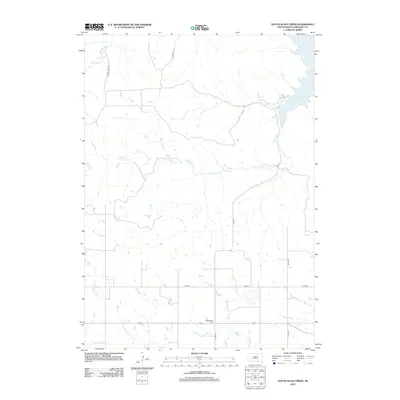
2012 Map of South Scalp Creek
USGS Topo · Published 2012About this map
Lake Francis Case dominates the northeastern corner of this South Dakota landscape, where the waters of the Missouri River have transformed the surrounding geography. The drainage network is defined by numerous seasonal and perennial flows, including the prominent branches of S Scalp Cr and N Scalp Cr, which meander toward the reservoir. In the southern reaches of Gregory County, the Bethelhem Cem stands as a focal point for local genealogy, situated near the intersection of the regional road network. The map reveals a systematic grid of section roads and thoroughfares like Co Hwy-1 and Lindley Twp Hwy, illustrating the agricultural layout of the plains. This 2012 survey captures the modern rural configuration of the area, where watercourses like Tobacco Cr and Joe Days Cr carve through the prairie towards the larger Missouri River system.
Find a feature on this map
12 named features on this map. Tap any name to fly to it.
Don’t see what you’re looking for? This feature index may not catch every label — zoom into the map to look around manually.
Map Details
Editions of this 2012 South Scalp Creek Map
This is the sole edition of this map. No revisions or reprints were ever made.
Other maps of this area

1951 · Butte NW
USGS Topo · 1:24,000

1955 · Mitchell
USGS Topo · 1:250,000

1955 · O'Neill
USGS Topo · 1:250,000

1959 · O'Neill
USGS Topo · 1:250,000

1959 · Mitchell
USGS Topo · 1:250,000

1964 · Campbell Creek
USGS Topo · 1:24,000

1964 · Butte
USGS Topo · 1:24,000

1964 · Whetstone Bay
USGS Topo · 1:24,000

1964 · Lake Andes NW
USGS Topo · 1:24,000

1964 · Lake Andes SW
USGS Topo · 1:24,000