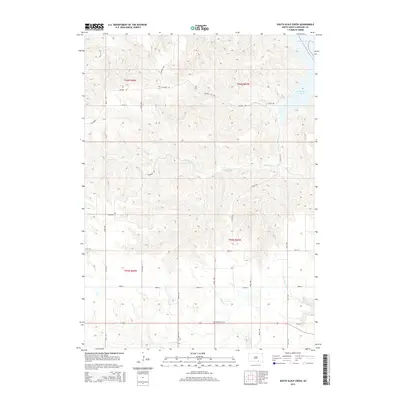
2015 Map of South Scalp Creek
USGS Topo · Published 2015About this map
Missouri River bluffs and deeply incised drainage systems define this section of Gregory County, where the sprawling Lake Francis Case reservoir meets the rugged upland prairie. The landscape is carved by numerous seasonal and permanent waterways, including N Scalp Cr, S Scalp Cr, and Tobacco Cr, which flow eastward toward the river valley. This 2015 survey illustrates a rural environment maintained by a strict section-line road grid, featuring thoroughfares like 366th Ave and 369th Ave. A solitary cultural landmark, the Bethelhem Cem, stands as a point of interest for genealogists and local historians researching the early settlement patterns of the region. The map also records localized infrastructure such as Quarry Rd and Blueridge Rd, reflecting the area's continued use for transit and resource access along the Missouri's western breaks.
Find a feature on this map
27 named features on this map. Tap any name to fly to it.
Don’t see what you’re looking for? This feature index may not catch every label — zoom into the map to look around manually.
Map Details
Editions of this 2015 South Scalp Creek Map
This is the sole edition of this map. No revisions or reprints were ever made.
Other maps of this area

1951 · Butte NW
USGS Topo · 1:24,000

1955 · Mitchell
USGS Topo · 1:250,000

1955 · O'Neill
USGS Topo · 1:250,000

1959 · O'Neill
USGS Topo · 1:250,000

1959 · Mitchell
USGS Topo · 1:250,000

1964 · Campbell Creek
USGS Topo · 1:24,000

1964 · Butte
USGS Topo · 1:24,000

1964 · Whetstone Bay
USGS Topo · 1:24,000

1964 · Lake Andes NW
USGS Topo · 1:24,000

1964 · Lake Andes SW
USGS Topo · 1:24,000