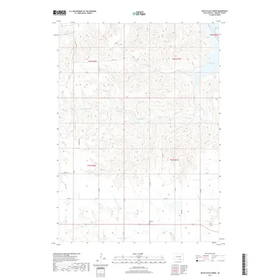
2017 Map of South Scalp Creek
USGS Topo · Published 2017About this map
South Scalp Creek carves a winding path through this portion of Gregory County, eventually leading toward the expansive Lake Francis Case and the Missouri River in the northeast. The landscape is defined by its drainage systems, including the southern reach of Joe Day Creek and the western drainage of Dry Cr. This modern 2017 survey reflects a rural interior structured by a grid of county roads and section lines, such as Co RD 52 and Blueridge Rd, which navigate the varying elevations. The Bethelhem Cem stands as a primary genealogical landmark along the southern edge of the map, situated near the intersection of 368 Ave and Highway 18. The map illustrates the contemporary rural layout of South Dakota's river country, where long-established section boundaries like t96n r67w meet the developed shoreline of the Missouri's reservoir system.
Find a feature on this map
27 named features on this map. Tap any name to fly to it.
Don’t see what you’re looking for? This feature index may not catch every label — zoom into the map to look around manually.
Map Details
Editions of this 2017 South Scalp Creek Map
This is the sole edition of this map. No revisions or reprints were ever made.
Other maps of this area

1951 · Butte NW
USGS Topo · 1:24,000

1955 · Mitchell
USGS Topo · 1:250,000

1955 · O'Neill
USGS Topo · 1:250,000

1959 · O'Neill
USGS Topo · 1:250,000

1959 · Mitchell
USGS Topo · 1:250,000

1964 · Campbell Creek
USGS Topo · 1:24,000

1964 · Butte
USGS Topo · 1:24,000

1964 · Whetstone Bay
USGS Topo · 1:24,000

1964 · Lake Andes NW
USGS Topo · 1:24,000

1964 · Lake Andes SW
USGS Topo · 1:24,000