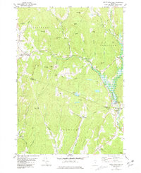
1981 Map of South Strafford
USGS Topo · Published 1981About this map
Industrial and rural patterns intersect at South Strafford, where the legacy of the Elizabeth Mine is clearly visible through the mapped Tailings and mine workings near Copperas Hill. The landscape is defined by the winding course of the Ompompanoosuc River and its West Branch, which support a series of small settlements and historical infrastructure including the Union Village Dam and multiple instances of a Covered Bridge.
Find a feature on this map
67 named features on this map. Tap any name to fly to it.
Don’t see what you’re looking for? This feature index may not catch every label — zoom into the map to look around manually.
Map Details
Editions of this 1981 South Strafford Map
2 editions found
Other maps of this area

1896 · Strafford
USGS Topo · 1:62,500

1906 · Hanover
USGS Topo · 1:62,500

1908 · Hanover
USGS Topo · 1:62,500

1927 · Mascoma
USGS Topo · 1:62,500

1931 · Mt. Cube
USGS Topo · 1:62,500

1932 · Mascoma
USGS Topo · 1:62,500

1933 · Mt. Cube
USGS Topo · 1:62,500

1944 · Strafford
USGS Topo · 1:62,500

1950 · Glens Falls
USGS Topo · 1:250,000

1956 · Glens Falls
USGS Topo · 1:250,000