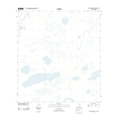
2012 Map of Southmost OE E
USGS Topo · Published 2012About this map
The meandering course of the Rio Grande defines the landscape of this border region, carving deep loops and abandoned oxbows across the flat terrain. This map highlights a largely rural and hydrologically complex area south of the main Texas population centers, where the river's historical shifts have left a series of distinctive resacas and wetlands. The only significant named inland landmark is the Old San Joaquin Ranch, situated near a prominent bend in the river. The lack of modern road networks or dense settlement patterns in this area emphasizes the preservation of the riparian environment and the traditional agricultural heritage of the Southmost region.
Find a feature on this map
2 named features on this map. Tap any name to fly to it.
Don’t see what you’re looking for? This feature index may not catch every label — zoom into the map to look around manually.
Map Details
Editions of this 2012 Southmost OE E Map
This is the sole edition of this map. No revisions or reprints were ever made.
Other maps of this area

1929 · Palmito Hill
USGS Topo · 1:24,000

1930 · East Brownsville
USGS Topo · 1:24,000

1936 · Palmito Hill
USGS Topo · 1:31,680
1936 · Mouth Of Rio Grande
USGS Topo · 1:31,680
1936 · East Brownsville
USGS Topo · 1:31,680
1936 · Southmost
USGS Topo · 1:31,680

1953 · Brownsville
USGS Topo · 1:250,000
1955 · Mouth Of Rio Grande
USGS Topo · 1:24,000
1955 · Mouth Of Rio Grande
USGS Topo · 1:62,500
1955 · Palmito Hill
USGS Topo · 1:24,000