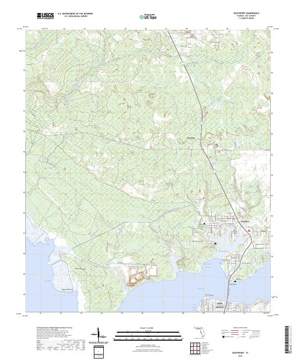
2024 Map of Southport
USGS Topo · Published 2024About this map
Southport and the northern outskirts of Lynn Haven define this coastal landscape where the waters of North Bay and West Bay meet. The map reveals a transition from the established residential grids along Nassau St and Riley Rd to the more sparsely settled northern reaches near Vicksburg. Local history is anchored by several burial grounds, including the Southport Memorial Gardens Cem and Grassy Point Cem, which serve as vital markers for genealogical research in this part of Bay County.
Find a feature on this map
86 named features on this map. Tap any name to fly to it.
Don’t see what you’re looking for? This feature index may not catch every label — zoom into the map to look around manually.
Map Details
Editions of this 2024 Southport Map
This is the sole edition of this map. No revisions or reprints were ever made.
Other maps of this area

1943 · Panama City
USGS Topo · 1:31,680

1943 · Panama City Beach
USGS Topo · 1:31,680

1943 · West Bay
USGS Topo · 1:24,000

1943 · Southport
USGS Topo · 1:24,000

1944 · Southport
USGS Topo · 1:24,000

1944 · West Bay
USGS Topo · 1:31,680

1944 · Crystal Lake
USGS Topo · 1:24,000

1944 · Bayhead
USGS Topo · 1:24,000

1944 · Bennett
USGS Topo · 1:24,000

1945 · Bennett
USGS Topo · 1:31,680