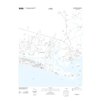
2013 Map of Southport
USGS Topo · Published 2013About this map
Southport stands at the maritime crossroads where the Elizabeth River meets the sea, serving as a hub for both commercial and recreational seafaring. This coastal landscape is defined by its strategic military and navigational history, anchored by Fort Caswell on the eastern tip of the island and the Oak Island Lighthouse near Caswell Basin. The shoreline transitions from the dense residential grids of Long Beach and Yaupon Beach to the protected marshlands and islands like Battery Island and Frazier Neck. Development north of the island is concentrated around infrastructure like the Cape Fear Regional Jetport/Howie Franklin Field Airport and modern nautical facilities including the South Harbour Village Marina. The interior remains largely influenced by the drainage patterns of Beaverdam Swamp and tidal creeks such as Dutchman Cr, illustrating the balance between expanding residential communities like Saint James and the natural coastal wetlands.
Find a feature on this map
215 named features on this map. Tap any name to fly to it.
Don’t see what you’re looking for? This feature index may not catch every label — zoom into the map to look around manually.
Map Details
Editions of this 2013 Southport Map
This is the sole edition of this map. No revisions or reprints were ever made.
Other maps of this area

1942 · Wilmington
USGS Topo · 1:62,500

1942 · Cape Fear
USGS Topo · 1:24,000

1943 · Funston
USGS Topo · 1:24,000

1943 · Bolivia
USGS Topo · 1:24,000

1943 · Lockwoods Folly
USGS Topo · 1:24,000

1944 · Bolivia
USGS Topo · 1:31,680

1944 · Lockwoods Folly
USGS Topo · 1:31,680

1946 · Southport
USGS Topo · 1:24,000

1946 · Snow Marsh
USGS Topo · 1:24,000

1948 · Wilmington
USGS Topo · 1:62,500