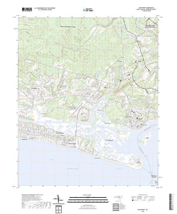
2022 Map of Southport
USGS Topo · Published 2022About this map
Southport and the surrounding coastal reaches of Brunswick County are detailed in this study of the Cape Fear River's mouth. The landscape is defined by the transition from mainland settlements like Boiling Spring Lakes and St. James to the barrier island communities of Oak Island and Caswell Beach. This 2022 survey documents the maritime and military heritage of the region, anchored by the significant Fort Caswell at the tip of the peninsula.
Find a feature on this map
167 named features on this map. Tap any name to fly to it.
Don’t see what you’re looking for? This feature index may not catch every label — zoom into the map to look around manually.
Map Details
Editions of this 2022 Southport Map
This is the sole edition of this map. No revisions or reprints were ever made.
Other maps of this area

1942 · Wilmington
USGS Topo · 1:62,500

1942 · Cape Fear
USGS Topo · 1:24,000

1943 · Funston
USGS Topo · 1:24,000

1943 · Bolivia
USGS Topo · 1:24,000

1943 · Lockwoods Folly
USGS Topo · 1:24,000

1944 · Bolivia
USGS Topo · 1:31,680

1944 · Lockwoods Folly
USGS Topo · 1:31,680

1946 · Southport
USGS Topo · 1:24,000

1946 · Snow Marsh
USGS Topo · 1:24,000

1948 · Wilmington
USGS Topo · 1:62,500