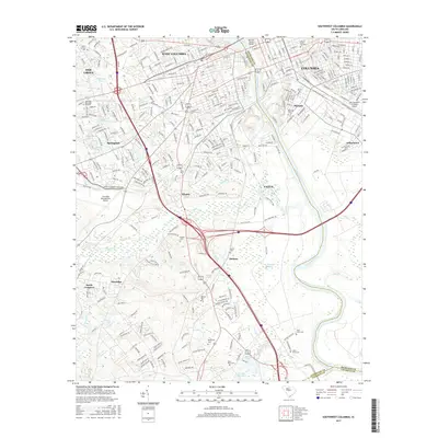
2017 Map of Southwest Columbia
USGS Topo · Published 2017About this map
The Congaree River divides the urban landscape of South Carolina’s capital, separating the core of Columbia from West Columbia and Cayce. This 2017 survey documents the dense infrastructure of the Midlands, from the campus of the Univ of South Carolina in the northeast to the Columbia Metropolitan Airport in the west. The map captures the industrial and residential evolution of historic mill districts like Olympia and early settlements such as Kinsler and Dixiana. South of the city, the terrain transitions into the wetlands of Hogabook Swamp and the winding course of Congaree Creek. Genealogists will find a high density of burial sites documented across the landscape, including the Mount Hermon Cem, Sighter Cem, and Saint Pauls Cem, alongside modern developments in Springdale and Pineridge.
Find a feature on this map
311 named features on this map. Tap any name to fly to it.
Don’t see what you’re looking for? This feature index may not catch every label — zoom into the map to look around manually.
Map Details
Editions of this 2017 Southwest Columbia Map
This is the sole edition of this map. No revisions or reprints were ever made.
Other maps of this area

1904 · Columbia
USGS Topo · 1:125,000

1935 · Killian
USGS Topo · 1:48,000

1937 · Killian
USGS Topo · 1:62,500

1941 · Spartanburg
USGS Topo · 1:250,000

1942 · Camden
USGS Topo · 1:125,000

1944 · Edmund
USGS Topo · 1:62,500

1946 · Irmo
USGS Topo · 1:24,000

1947 · Columbia North
USGS Topo · 1:24,000

1948 · Hopkins
USGS Topo · 1:62,500

1948 · Irmo
USGS Topo · 1:24,000