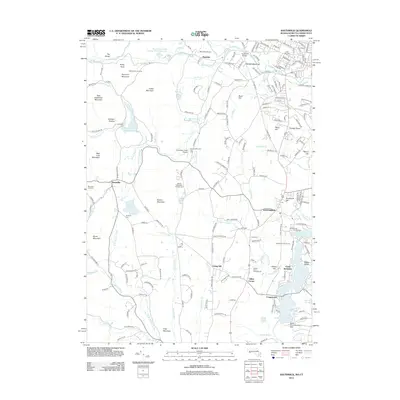
2012 Map of Southwick
USGS Topo · Published 2012About this map
Congamond Lakes South Pond and its neighboring basins anchor the southeastern corner of this study, reflecting the area's transition into a recreational and residential hub. The landscape is a complex mix of agricultural heritage, seen in Mountain Orchards and West Parish Orchards, alongside modern infrastructure like the Springfield Aqueduct. Transportation and leisure are intertwined throughout the terrain, from the small Mundale Airport to the Sodom Mountain Ski Area. For genealogists and local historians, several burial sites are documented across the township, including Granville Cem and Pine Hill Cem. The presence of the South Pond Seaplane Base on the Connecticut border highlights the unique multi-modal use of the local waterways during this period.
Find a feature on this map
202 named features on this map. Tap any name to fly to it.
Don’t see what you’re looking for? This feature index may not catch every label — zoom into the map to look around manually.
Map Details
Editions of this 2012 Southwick Map
This is the sole edition of this map. No revisions or reprints were ever made.
Other maps of this area

1886 · Springfield
USGS Topo · 1:62,500

1887 · Granville
USGS Topo · 1:62,500

1889 · Springfield
USGS Topo · 1:62,500

1889 · Granville
USGS Topo · 1:62,500

1892 · Hartford
USGS Topo · 1:62,500

1892 · Granby
USGS Topo · 1:62,500

1893 · Springfield
USGS Topo · 1:62,500

1893 · Granville
USGS Topo · 1:62,500

1895 · Springfield
USGS Topo · 1:62,500

1895 · Granville
USGS Topo · 1:62,500