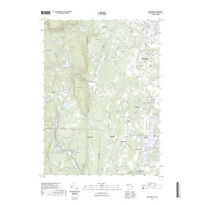
2023 Map of Southwick
USGS Topo · Published 2023About this map
Westfield and the rolling borderlands between Massachusetts and Connecticut are meticulously documented in this contemporary survey. The landscape is defined by the dramatic north-south rise of Metacomet Ridge and Sodom Mountain, which separate the developed eastern plains from the more remote highlands near Granville. These ridges are cut by watercourses like Munn Brook and the Little River, leading into The Gorge. In the south, the Congamond lake chain — comprising North Pond, Middle Pond, and South Pond — remains a primary geographic focal point, flanked by recreational landmarks such as Babbs Beach.
Find a feature on this map
167 named features on this map. Tap any name to fly to it.
Don’t see what you’re looking for? This feature index may not catch every label — zoom into the map to look around manually.
Map Details
Editions of this 2023 Southwick Map
This is the sole edition of this map. No revisions or reprints were ever made.
Other maps of this area

1886 · Springfield
USGS Topo · 1:62,500

1887 · Granville
USGS Topo · 1:62,500

1889 · Springfield
USGS Topo · 1:62,500

1889 · Granville
USGS Topo · 1:62,500

1892 · Hartford
USGS Topo · 1:62,500

1892 · Granby
USGS Topo · 1:62,500

1893 · Springfield
USGS Topo · 1:62,500

1893 · Granville
USGS Topo · 1:62,500

1895 · Springfield
USGS Topo · 1:62,500

1895 · Granville
USGS Topo · 1:62,500