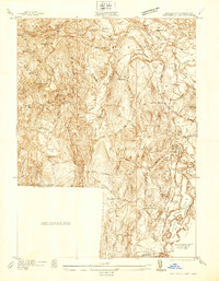
1937 Map of Southwick
USGS Topo · Published 1937About this map
The Westfield River and its complex tributaries define the topography of this 1937 survey, where industrial infrastructure meets the rural landscapes of Hampden County. Significant water management features, including the West Parish Filters and the Granville Reservoir, highlight the region's role in supporting nearby urban needs. Settlement patterns are centered around Southwick and Granville, connected by a network of local thoroughfares such as College Highway and Feeding Hills Rd.
Find a feature on this map
70 named features on this map. Tap any name to fly to it.
Don’t see what you’re looking for? This feature index may not catch every label — zoom into the map to look around manually.
Map Details
Editions of this 1937 Southwick Map
This is the sole edition of this map. No revisions or reprints were ever made.
Other maps of this area

1886 · Springfield
USGS Topo · 1:62,500

1887 · Granville
USGS Topo · 1:62,500

1889 · Springfield
USGS Topo · 1:62,500

1889 · Granville
USGS Topo · 1:62,500

1892 · Hartford
USGS Topo · 1:62,500

1892 · Granby
USGS Topo · 1:62,500

1893 · Springfield
USGS Topo · 1:62,500

1893 · Granville
USGS Topo · 1:62,500

1895 · Springfield
USGS Topo · 1:62,500

1895 · Granville
USGS Topo · 1:62,500