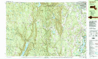
1987 Map of Southwick
USGS Topo · Published 1988About this map
Southwick and the Granville uplands define this 1980s landscape along the Massachusetts and Connecticut border. The map captures a transition from the agricultural and residential clusters of the Pioneer Valley into the densely forested tracts of Granville State Forest and Tunxis State Forest. Local history is anchored by numerous small settlements like West Granville and Granville Center, alongside community landmarks such as Woodland Sch and several family burying grounds, including South Quarter Cem and Tolland Cem.
Find a feature on this map
106 named features on this map. Tap any name to fly to it.
Don’t see what you’re looking for? This feature index may not catch every label — zoom into the map to look around manually.
Map Details
Editions of this 1987 Southwick Map
This is the sole edition of this map. No revisions or reprints were ever made.
Other maps of this area

1886 · Springfield
USGS Topo · 1:62,500

1887 · Granville
USGS Topo · 1:62,500

1888 · Sandisfield
USGS Topo · 1:62,500

1889 · Springfield
USGS Topo · 1:62,500

1889 · Granville
USGS Topo · 1:62,500

1892 · Winsted
USGS Topo · 1:62,500

1892 · Hartford
USGS Topo · 1:62,500

1892 · Granby
USGS Topo · 1:62,500

1893 · Springfield
USGS Topo · 1:62,500

1893 · Granville
USGS Topo · 1:62,500