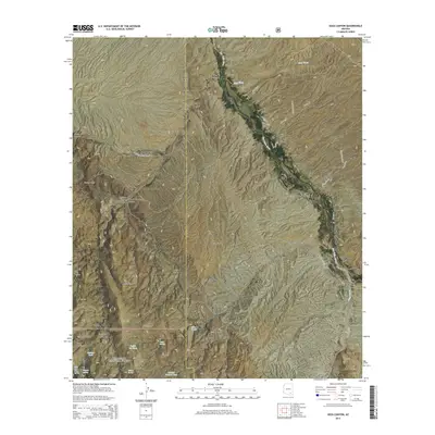
2014 Map of Soza Canyon
USGS Topo · Published 2014About this map
The San Pedro River corridor near Cascabel anchors this portion of the high desert landscape, marking the boundary between the Coronado National Forest and local ranching lands. To the southwest, the foothills of the Rincon Mountains rise into a series of prominent landforms including Mineta Ridge, Banco Ridge, and White Ridge. This territory is defined by its drainage systems, where Soza Wash and Soza Canyon cut through the terrain toward the river valley. Water sources are critical markers here, with named features such as Coffee Pot Tank, Hidden Tank, and Pelon Spring punctuating the arid highlands. The map also traces the local transportation network, highlighting the intersection of N Cascabel Rd and Soza Rd, which follow the natural contours of the valley and canyon floor.
Find a feature on this map
42 named features on this map. Tap any name to fly to it.
Don’t see what you’re looking for? This feature index may not catch every label — zoom into the map to look around manually.
Map Details
Editions of this 2014 Soza Canyon Map
This is the sole edition of this map. No revisions or reprints were ever made.
Other maps of this area

1904 · Tucson
USGS Topo · 1:125,000

1905 · Tucson
USGS Topo · 1:125,000

1945 · Redington
USGS Topo · 1:62,500

1945 · Happy Valley
USGS Topo · 1:62,500

1956 · Tucson
USGS Topo · 1:250,000

1957 · Bellota Ranch
USGS Topo · 1:62,500

1957 · Rincon Valley
USGS Topo · 1:62,500

1957 · Redington
USGS Topo · 1:62,500

1958 · Tucson
USGS Topo · 1:250,000

1958 · Happy Valley
USGS Topo · 1:62,500