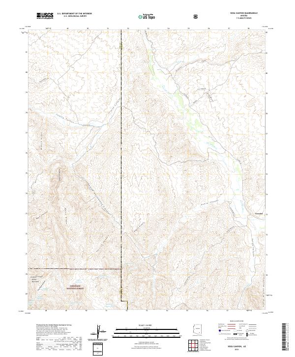
2021 Map of Soza Canyon
USGS Topo · Published 2021About this map
The San Pedro River corridor near the settlement of Cascabel defines this high-desert landscape in Cochise and Pima counties. This 2021 topographic study illustrates the transition from the river valley to the foothills of the Rincon Mountains, highlighting a terrain deeply etched by arroyos like Soza Canyon and Youtcy Canyon. Within the eastern reaches of the Coronado National Forest, water management for livestock and wildlife is evident through numerous named sources such as Coffee Pot Tank, Hidden Tank, and Roble Spring.
Find a feature on this map
44 named features on this map. Tap any name to fly to it.
Don’t see what you’re looking for? This feature index may not catch every label — zoom into the map to look around manually.
Map Details
Editions of this 2021 Soza Canyon Map
This is the sole edition of this map. No revisions or reprints were ever made.
Other maps of this area

1904 · Tucson
USGS Topo · 1:125,000

1905 · Tucson
USGS Topo · 1:125,000

1945 · Redington
USGS Topo · 1:62,500

1945 · Happy Valley
USGS Topo · 1:62,500

1956 · Tucson
USGS Topo · 1:250,000

1957 · Bellota Ranch
USGS Topo · 1:62,500

1957 · Rincon Valley
USGS Topo · 1:62,500

1957 · Redington
USGS Topo · 1:62,500

1958 · Tucson
USGS Topo · 1:250,000

1958 · Happy Valley
USGS Topo · 1:62,500