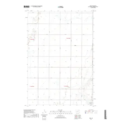
2017 Map of Spain
USGS Topo · Published 2017About this map
Spain serves as the central point of this Marshall County survey, located within the expansive geographic region of the Coteau des Prairies. The landscape is defined by the winding course of Crow Cr in the northern reaches, which cuts through a territory marked by numerous small wetlands and glacial depressions characteristic of this plateau. This map illustrates a highly organized section-line road grid, where arterial routes like Co Hwy 12 and Co Hwy 9 intersect with local roads such as 115th St and 421st Ave. The cartography emphasizes the rural transition between the high prairie and the agricultural fields of the Dakotas, providing a clear view of land divisions within Township 125 and 126 North.
Find a feature on this map
22 named features on this map. Tap any name to fly to it.
Don’t see what you’re looking for? This feature index may not catch every label — zoom into the map to look around manually.
Map Details
Editions of this 2017 Spain Map
This is the sole edition of this map. No revisions or reprints were ever made.
Other maps of this area

1953 · Britton East
USGS Topo · 1:24,000

1953 · Newark SW
USGS Topo · 1:24,000

1953 · Milbank
USGS Topo · 1:250,000

1956 · Britton West
USGS Topo · 1:24,000

1958 · Milbank
USGS Topo · 1:250,000

1958 · Spain
USGS Topo · 1:24,000

1958 · Britton 4 NW
USGS Topo · 1:24,000

1958 · Britton 4 SW
USGS Topo · 1:24,000
1958 · Amherst
USGS Topo · 1:24,000

1958 · Langford
USGS Topo · 1:24,000