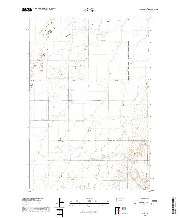
2021 Map of Spain
USGS Topo · Published 2021About this map
The settlement of Spain sits along the southern edge of Marshall County, marking a quiet point of human presence in the northeastern South Dakota landscape. This 2021 survey reveals a vast agricultural grid defined by long stretches of section roads like 118th St and 420th Ave. The terrain is characterized by the prominent elevation of the Coteau des Prairies, a high plateau that rises above the surrounding plains. The drainage of Crow Cr meanders across the northern portion of the quadrangle, illustrating the natural water patterns that persist alongside the geometric precision of county highways. This map is particularly useful for understanding modern land management and the enduring structure of the Public Land Survey System, as seen in the boundary markers for t126n r58w and surrounding townships.
Find a feature on this map
22 named features on this map. Tap any name to fly to it.
Don’t see what you’re looking for? This feature index may not catch every label — zoom into the map to look around manually.
Map Details
Editions of this 2021 Spain Map
This is the sole edition of this map. No revisions or reprints were ever made.
Other maps of this area

1953 · Britton East
USGS Topo · 1:24,000

1953 · Newark SW
USGS Topo · 1:24,000

1953 · Milbank
USGS Topo · 1:250,000

1956 · Britton West
USGS Topo · 1:24,000

1958 · Milbank
USGS Topo · 1:250,000

1958 · Spain
USGS Topo · 1:24,000

1958 · Britton 4 NW
USGS Topo · 1:24,000

1958 · Britton 4 SW
USGS Topo · 1:24,000
1958 · Amherst
USGS Topo · 1:24,000

1958 · Langford
USGS Topo · 1:24,000