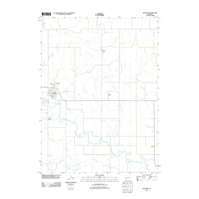
2011 Map of Spalding
USGS Topo · Published 2011About this map
Spalding sits at the heart of this rural Nebraska landscape, where the Cedar River winds eastward through a grid of country roads. The settlement is anchored by the Spalding Post Office and several local burial grounds, including Calvary Cemetery, Grand View Cemetery, and Saint Michaels Cemetery. The surrounding agricultural lands are defined by the courses of Mud Creek and Freeman Creek, with small aviation facilities like McKay Airport and Glaser Airport serving the farming community.
Find a feature on this map
19 named features on this map. Tap any name to fly to it.
Don’t see what you’re looking for? This feature index may not catch every label — zoom into the map to look around manually.
Map Details
Editions of this 2011 Spalding Map
This is the sole edition of this map. No revisions or reprints were ever made.
Other maps of this area

1954 · Cedar Rapids
USGS Topo · 1:24,000

1954 · Spalding
USGS Topo · 1:24,000

1954 · Spalding SW
USGS Topo · 1:24,000

1954 · Akron
USGS Topo · 1:24,000

1954 · Spalding NW
USGS Topo · 1:24,000

1954 · Spalding SE
USGS Topo · 1:24,000

1955 · Broken Bow
USGS Topo · 1:250,000

1956 · Broken Bow
USGS Topo · 1:250,000

1960 · Spalding 2 SW
USGS Topo · 1:24,000

1960 · Spalding 2 SE
USGS Topo · 1:24,000