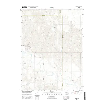
2014 Map of Spalding
USGS Topo · Published 2014About this map
Spalding serves as the primary hub of this eastern Nebraska landscape, situated near the confluence where the Cedar River meets its local tributaries. The settlement's history and community foundations are clearly marked by a cluster of sites including Calvary Cem and Grand View Cem to the north, while Saint Michaels Cem lies to the south. The surrounding rural layout is defined by a grid of section roads and the winding paths of Mud Cr and Freeman Cr. To the north, the small Mc Kay Airport and roads like Ghost Town Ave and Old Highway 101 provide evidence of changing transportation patterns and historical routes through Greeley, Wheeler, and Boone counties.
Find a feature on this map
49 named features on this map. Tap any name to fly to it.
Don’t see what you’re looking for? This feature index may not catch every label — zoom into the map to look around manually.
Map Details
Editions of this 2014 Spalding Map
This is the sole edition of this map. No revisions or reprints were ever made.
Other maps of this area

1954 · Cedar Rapids
USGS Topo · 1:24,000

1954 · Spalding
USGS Topo · 1:24,000

1954 · Spalding SW
USGS Topo · 1:24,000

1954 · Akron
USGS Topo · 1:24,000

1954 · Spalding NW
USGS Topo · 1:24,000

1954 · Spalding SE
USGS Topo · 1:24,000

1955 · Broken Bow
USGS Topo · 1:250,000

1956 · Broken Bow
USGS Topo · 1:250,000

1960 · Spalding 2 SW
USGS Topo · 1:24,000

1960 · Spalding 2 SE
USGS Topo · 1:24,000