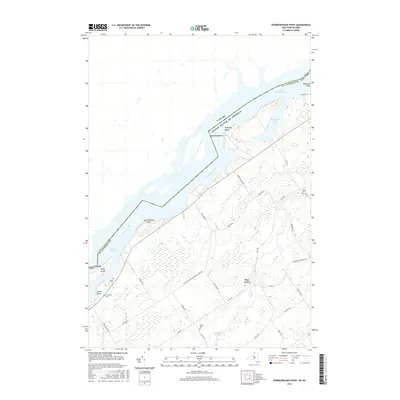
2016 Map of Sparrowhawk Point
USGS Topo · Published 2016About this map
The Saint Lawrence River serves as the international boundary between St. Lawrence Co, New York, and Ontario, Canada, shaping the life and geography of this border region. Along the southern shore, the landscape is defined by points and bays such as Sparrowhawk Point, Rockway Point, and Whitehouse Bay, which overlook the expansive Lake Saint Lawrence. This 2016 survey documents the rural character of the area, centered on the settlement of Pine Grove and the recreational stretch of Lisbon Beach. A network of country roads, including Nelson Bullrun Keystone Hanlon Rd, connects the shoreline to interior farms. For genealogists, the map preserves the locations of several historic burial grounds, including Union Cem, Martin Cem, Livingston Cem, and O'Neill Cem, providing a spatial record of the families who settled this northern frontier.
Find a feature on this map
35 named features on this map. Tap any name to fly to it.
Don’t see what you’re looking for? This feature index may not catch every label — zoom into the map to look around manually.
Map Details
Editions of this 2016 Sparrowhawk Point Map
This is the sole edition of this map. No revisions or reprints were ever made.
Other maps of this area

1904 · Lisbon
USGS Topo · 1:48,000

1904 · Ogdensburg
USGS Topo · 1:62,500

1905 · Waddington
USGS Topo · 1:62,500

1905 · Ogdensburg
USGS Topo · 1:62,500

1906 · Red Mills
USGS Topo · 1:62,500

1910 · Canton
USGS Topo · 1:62,500

1911 · Canton
USGS Topo · 1:62,500

1942 · Waddington
USGS Topo · 1:24,000

1942 · Murphy Island
USGS Topo · 1:24,000

1943 · Ogdensburg East
USGS Topo · 1:31,680