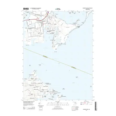
2014 Map of Sparrows Point
USGS Topo · Published 2014About this map
Sparrows Point dominates the northwestern industrial landscape of this survey, where the heavy infrastructure of the steel era is evident through labels like W Blast Furnace Rd, E Blast Furnace Rd, and Coal Plant Rd. These industrial corridors contrast with the dense residential developments of Edgemere and Lodge Forest that sit just east of Old Road Bay. At the southern tip of the peninsula, Fort Howard stands as a sentinel over the approach to the Patapsco River.
Find a feature on this map
103 named features on this map. Tap any name to fly to it.
Don’t see what you’re looking for? This feature index may not catch every label — zoom into the map to look around manually.
Map Details
Editions of this 2014 Sparrows Point Map
This is the sole edition of this map. No revisions or reprints were ever made.
Other maps of this area

1893 · North Point
USGS Topo · 1:62,500

1893 · Gunpowder
USGS Topo · 1:62,500

1894 · Baltimore
USGS Topo · 1:62,500

1894 · Relay
USGS Topo · 1:62,500

1898 · Tolchester
USGS Topo · 1:125,000

1899 · Baltimore
USGS Topo · 1:62,500

1901 · Gunpowder
USGS Topo · 1:62,500

1903 · Tolchester
USGS Topo · 1:125,000

1904 · Baltimore
USGS Topo · 1:62,500

1904 · North Point
USGS Topo · 1:62,500