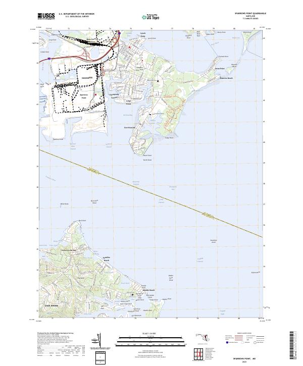
2023 Map of Sparrows Point
USGS Topo · Published 2023About this map
Fort Howard and the industrial coastline of Sparrows Point dominate this maritime landscape where the Patapsco River meets the Chesapeake Bay. The geography is defined by a dense network of peninsulas including Back River Neck and Bodkin Neck, separated by numerous inlets such as Bear Creek and Main Creek. For those researching local heritage, the map identifies several significant burial sites including Todds Inheritance Cem and the Shaw Family Cem, alongside established residential communities like Edgemere and Lodge Forest.
Find a feature on this map
98 named features on this map. Tap any name to fly to it.
Don’t see what you’re looking for? This feature index may not catch every label — zoom into the map to look around manually.
Map Details
Editions of this 2023 Sparrows Point Map
This is the sole edition of this map. No revisions or reprints were ever made.
Other maps of this area

1893 · North Point
USGS Topo · 1:62,500

1893 · Gunpowder
USGS Topo · 1:62,500

1894 · Baltimore
USGS Topo · 1:62,500

1894 · Relay
USGS Topo · 1:62,500

1898 · Tolchester
USGS Topo · 1:125,000

1899 · Baltimore
USGS Topo · 1:62,500

1901 · Gunpowder
USGS Topo · 1:62,500

1903 · Tolchester
USGS Topo · 1:125,000

1904 · Baltimore
USGS Topo · 1:62,500

1904 · North Point
USGS Topo · 1:62,500