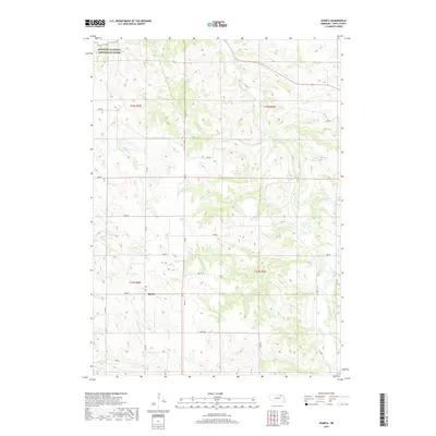
2017 Map of Sparta
USGS Topo · Published 2017About this map
Sparta sits at the heart of this Knox County landscape, where the rural grid of the northern Nebraska plains meets the dynamic drainages of the Missouri River valley. The northern edge of the map is defined by the Missouri National Recreation River, a protected corridor that preserves the free-flowing character of this historic waterway. The terrain is deeply incised by a network of seasonal and perennial streams, including Bingham Cr and Burgess Cr, which carve through the loess hills to feed the larger river system. This topography dictates the winding paths of local routes like 531 Ave and 887 Rd as they navigate the ridges and draws. In the eastern portion of the quadrangle, Vakoc Reservoir and Bazile Creek provide notable water features in an area otherwise dominated by high-plateau agriculture and ranching.
Find a feature on this map
26 named features on this map. Tap any name to fly to it.
Don’t see what you’re looking for? This feature index may not catch every label — zoom into the map to look around manually.
Map Details
Editions of this 2017 Sparta Map
This is the sole edition of this map. No revisions or reprints were ever made.
Other maps of this area

1950 · Niobrara
USGS Topo · 1:24,000

1950 · Verdigre NE
USGS Topo · 1:24,000

1954 · Verdigre
USGS Topo · 1:24,000

1955 · Sioux City
USGS Topo · 1:250,000

1955 · O'Neill
USGS Topo · 1:250,000

1958 · Sioux City
USGS Topo · 1:250,000

1959 · O'Neill
USGS Topo · 1:250,000

1959 · Sioux City
USGS Topo · 1:250,000

1969 · O'Neill
USGS Topo · 1:250,000

1974 · Sparta
USGS Topo · 1:24,000