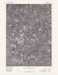
1977 Map of Sparta
USGS Topo · Published 1979About this map
Sparta stands as a focal point in this 1977 orthophotoquad, which provides a photographic perspective of the Knox County landscape. Produced in cooperation with the Bureau of Indian Affairs, the imagery reveals a distinct pattern of agricultural land use and natural drainage. The winding course of Bazile Creek meanders through the eastern portion of the quadrangle, carving a riparian corridor through the surrounding fields and pastures. This specific format, utilizing rectified photoimagery rather than traditional topographic lines, allows for a clear visual analysis of the terrain and vegetation patterns as they existed in the late 1970s, highlighting the intersection of rural development and the local waterway.
Find a feature on this map
2 named features on this map. Tap any name to fly to it.
Don’t see what you’re looking for? This feature index may not catch every label — zoom into the map to look around manually.
Map Details
Editions of this 1977 Sparta Map
This is the sole edition of this map. No revisions or reprints were ever made.
Other maps of this area

1950 · Niobrara
USGS Topo · 1:24,000

1950 · Verdigre NE
USGS Topo · 1:24,000

1954 · Verdigre
USGS Topo · 1:24,000

1955 · Sioux City
USGS Topo · 1:250,000

1955 · O'Neill
USGS Topo · 1:250,000

1958 · Sioux City
USGS Topo · 1:250,000

1959 · O'Neill
USGS Topo · 1:250,000

1959 · Sioux City
USGS Topo · 1:250,000

1969 · O'Neill
USGS Topo · 1:250,000

1974 · Sparta
USGS Topo · 1:24,000