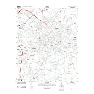
2011 Map of Spartanburg
USGS Topo · Published 2011About this map
Spartanburg serves as the focal point of this 2011 survey, showing a dense network of suburban expansion and historical neighborhoods. The area north of the city center includes the University of South Carolina Upstate campus and the industrial legacy of textile-era settlements like Saxon, Drayton, and Arcadia. These locations, many situated near the banks of Lawsons Fork Creek and Fairforest Creek, reflect the early twentieth-century mill village origins that shaped the region's development.
Find a feature on this map
268 named features on this map. Tap any name to fly to it.
Don’t see what you’re looking for? This feature index may not catch every label — zoom into the map to look around manually.
Map Details
Editions of this 2011 Spartanburg Map
This is the sole edition of this map. No revisions or reprints were ever made.
Other maps of this area

1907 · Saluda
USGS Topo · 1:125,000

1935 · Greer
USGS Topo · 1:48,000

1938 · Greer
USGS Topo · 1:62,500

1941 · Spartanburg
USGS Topo · 1:250,000

1947 · Spartanburg
USGS Topo · 1:62,500

1949 · Spartanburg
USGS Topo · 1:24,000

1949 · Spartanburg
USGS Topo · 1:62,500

1953 · Spartanburg
USGS Topo · 1:250,000

1953 · Charlotte
USGS Topo · 1:250,000

1954 · Charlotte
USGS Topo · 1:250,000