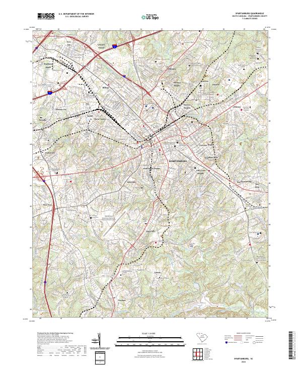
2024 Map of Spartanburg
USGS Topo · Published 2024About this map
The textile and railroad hub of Spartanburg serves as the focal point for this modern landscape, where historical resting places and collegiate campuses meet contemporary infrastructure. Dense residential pockets like Converse Heights and Washington Heights surround the urban core, while the map reveals numerous ancestral sites including the Stephen Grove African Methodist Episcopal Zion Church Graveyard and Patterson Family Cem. These sites, alongside the Old City Cem, offer essential data for genealogists tracing South Carolina lineages.
Find a feature on this map
92 named features on this map. Tap any name to fly to it.
Don’t see what you’re looking for? This feature index may not catch every label — zoom into the map to look around manually.
Map Details
Editions of this 2024 Spartanburg Map
This is the sole edition of this map. No revisions or reprints were ever made.
Other maps of this area

1907 · Saluda
USGS Topo · 1:125,000

1935 · Greer
USGS Topo · 1:48,000

1938 · Greer
USGS Topo · 1:62,500

1941 · Spartanburg
USGS Topo · 1:250,000

1947 · Spartanburg
USGS Topo · 1:62,500

1949 · Spartanburg
USGS Topo · 1:24,000

1949 · Spartanburg
USGS Topo · 1:62,500

1953 · Spartanburg
USGS Topo · 1:250,000

1953 · Charlotte
USGS Topo · 1:250,000

1954 · Charlotte
USGS Topo · 1:250,000