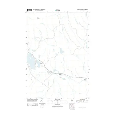
2012 Map of Spectacle Pond
USGS Topo · Published 2012About this map
Bluff Mountain stands as the prominent landmark in this northeastern Vermont landscape, presiding over a dense network of glacial ponds and river branches near the Canadian border. The drainage patterns of the N Br Nulhegan River and various tributaries like Whiskey Brook and Clay Hill Brook define the topography, revealing a wetland-rich environment where land and water frequently merge. The settlement at East Brighton and the remote location of Wenlock are linked by a corridor of transportation that includes the John H Boylan State Airport and roads such as McConnell Pond Rd. This 2012 survey illustrates a region largely defined by its natural water features, including Spectacle Pond, Island Pond, and the secluded McConnell Pond, showing the area's transition from historical timber resource to its modern character as a recreational and aviation gateway.
Find a feature on this map
48 named features on this map. Tap any name to fly to it.
Don’t see what you’re looking for? This feature index may not catch every label — zoom into the map to look around manually.
Map Details
Editions of this 2012 Spectacle Pond Map
This is the sole edition of this map. No revisions or reprints were ever made.
Other maps of this area

1920 · Guildhall
USGS Topo · 1:62,500

1924 · Island Pond
USGS Topo · 1:48,000

1926 · Island Pond
USGS Topo · 1:62,500

1929 · Averill
USGS Topo · 1:62,500

1931 · Guildhall
USGS Topo · 1:48,000

1933 · Guildhall
USGS Topo · 1:48,000

1937 · Guildhall
USGS Topo · 1:62,500

1950 · Lewiston
USGS Topo · 1:250,000

1951 · Burke
USGS Topo · 1:62,500

1953 · Island Pond
USGS Topo · 1:62,500