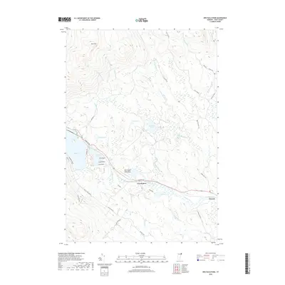
2018 Map of Spectacle Pond
USGS Topo · Published 2018About this map
East Brighton and the eastern edge of Island Pond anchor this Essex County landscape, where the Nulhegan River and its numerous tributaries create a complex network of wetlands and ponds. The northern reaches are dominated by Bluff Mtn and the remote waters of McConnell Pond and Mud Pond, while the southern valley carries the infrastructure of E Brighton Rd and the John H Boylan State Airport. This 2018 survey captures a terrain defined by recreational transitions, featuring the long-distance Catamount Trail and the Spigot Rail Trail following former rail corridors. From the isolated settlement of Wenlock to the family-named points like Eagle Point and Loon Point on Spectacle Pond, the map details a region where logging roads like N Branch Rd and Lewis Pond Rd provide the primary access through the dense Vermont woods.
Find a feature on this map
48 named features on this map. Tap any name to fly to it.
Don’t see what you’re looking for? This feature index may not catch every label — zoom into the map to look around manually.
Map Details
Editions of this 2018 Spectacle Pond Map
This is the sole edition of this map. No revisions or reprints were ever made.
Other maps of this area

1920 · Guildhall
USGS Topo · 1:62,500

1924 · Island Pond
USGS Topo · 1:48,000

1926 · Island Pond
USGS Topo · 1:62,500

1929 · Averill
USGS Topo · 1:62,500

1931 · Guildhall
USGS Topo · 1:48,000

1933 · Guildhall
USGS Topo · 1:48,000

1937 · Guildhall
USGS Topo · 1:62,500

1950 · Lewiston
USGS Topo · 1:250,000

1951 · Burke
USGS Topo · 1:62,500

1953 · Island Pond
USGS Topo · 1:62,500