2021 Map of Spectacle Pond
USGS Topo · Published 2021About this map
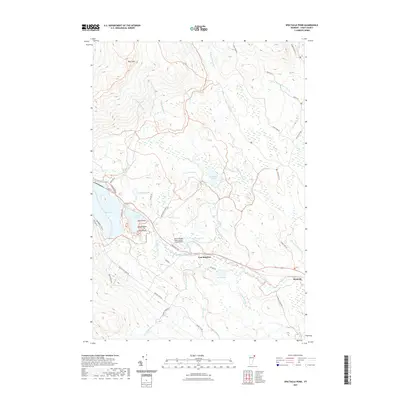
East Brighton and the small settlement of Wenlock anchor the riverfront of the Nulhegan River in this Essex County landscape. The area is defined by a dense network of glacial water bodies, including Spectacle Pond, Island Pond, and the secluded McConnell Pond. To the northwest, the elevation rises sharply toward Bluff Mtn, while the lowlands are marked by the John H Boylan State Airport and a complex of brooks such as Whiskey Brook and Tuffield Wiggin Brook. This 2021 survey illustrates a modern remote Vermont wilderness where traditional land use and recreation meet, highlighted by named features like Pine Point and Eagle Point. The map also traces the Spigot Rail Trl and the well-known Catamount Trl, showing how old transportation corridors and modern trails navigate the wetlands around Nulhegan Pond and Mile Pond.
Find a feature on this map
50 named features on this map. Tap any name to fly to it.
Don’t see what you’re looking for? This feature index may not catch every label — zoom into the map to look around manually.
Map Details
Editions of this 2021 Spectacle Pond Map
This is the sole edition of this map. No revisions or reprints were ever made.
Other maps of this area

1920 · Guildhall
USGS Topo · 1:62,500

1924 · Island Pond
USGS Topo · 1:48,000

1926 · Island Pond
USGS Topo · 1:62,500

1929 · Averill
USGS Topo · 1:62,500

1931 · Guildhall
USGS Topo · 1:48,000

1933 · Guildhall
USGS Topo · 1:48,000

1937 · Guildhall
USGS Topo · 1:62,500

1950 · Lewiston
USGS Topo · 1:250,000

1951 · Burke
USGS Topo · 1:62,500

1953 · Island Pond
USGS Topo · 1:62,500