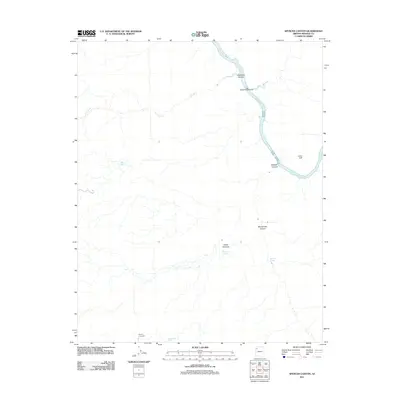
2011 Map of Spencer Canyon
USGS Topo · Published 2011About this map
The Colorado River cuts through the desert floor of Mohave County in this 2011 survey, creating a dramatic landscape of steep drops and river-carved passages. Remote springs such as Meriwhitica Springs, White Spring, and Spencer Springs serve as critical water sources in an otherwise arid environment, while the Meriwhitica Tank provides a managed water point further inland. The map details the technical challenges of the river itself, identifying the Surprise Rapids and Spencer Rapids that would be of high interest to river navigators and backcountry explorers.
Find a feature on this map
15 named features on this map. Tap any name to fly to it.
Don’t see what you’re looking for? This feature index may not catch every label — zoom into the map to look around manually.
Map Details
Editions of this 2011 Spencer Canyon Map
This is the sole edition of this map. No revisions or reprints were ever made.
Other maps of this area

1886 · Diamond Creek
USGS Topo · 1:250,000

1892 · Diamond Creek
USGS Topo · 1:250,000

1948 · Williams
USGS Topo · 1:250,000

1954 · Williams
USGS Topo · 1:250,000

1956 · Williams
USGS Topo · 1:250,000

1960 · Williams
USGS Topo · 1:250,000

1961 · Williams
USGS Topo · 1:250,000
1967 · Milkweed Canyon NW
USGS Topo · 1:24,000
1967 · Separation Canyon
USGS Topo · 1:24,000
1967 · Devils Slide Rapids
USGS Topo · 1:24,000