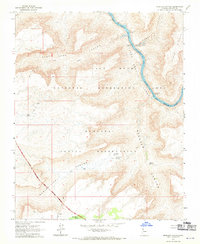
1967 Map of Spencer Canyon
USGS Topo · Published 1970About this map
The Colorado River carves a deep path through the Granite Gorge in this 1960s topographic study of Mohave County. This landscape is defined by the intersection of the Hualapai Indian Reservation and the Lake Mead National Recreation Area, where the river’s descent is marked by hazardous stretches like Lost Creek Rapids, Surprise Rapids, and Lava Cliff Rapids. The terrain transitions sharply from the elevated Sanup Plateau into deep drainages such as Surprise Canyon and Spencer Canyon.
Find a feature on this map
26 named features on this map. Tap any name to fly to it.
Don’t see what you’re looking for? This feature index may not catch every label — zoom into the map to look around manually.
Map Details
Editions of this 1967 Spencer Canyon Map
This is the sole edition of this map. No revisions or reprints were ever made.
Other maps of this area

1886 · Diamond Creek
USGS Topo · 1:250,000

1892 · Diamond Creek
USGS Topo · 1:250,000

1948 · Williams
USGS Topo · 1:250,000

1954 · Williams
USGS Topo · 1:250,000

1956 · Williams
USGS Topo · 1:250,000

1960 · Williams
USGS Topo · 1:250,000

1961 · Williams
USGS Topo · 1:250,000
1967 · Milkweed Canyon NW
USGS Topo · 1:24,000
1967 · Separation Canyon
USGS Topo · 1:24,000
1967 · Devils Slide Rapids
USGS Topo · 1:24,000