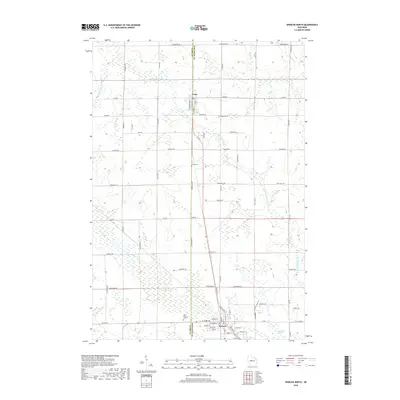
2018 Map of Spencer North
USGS Topo · Published 2018About this map
Unity and Spencer anchor the central corridor of this Marathon and Clark County landscape, where the survey details a transition from organized agricultural grids to the complex hydrology of central Wisconsin. The northern reaches are defined by the meandering path of the Little Eau Pleine River and smaller tributaries like Winding Cr and Bill Cr. To the south, the terrain shifts into significant wetland systems, most notably Spencer Marsh and the western edge of McMillan Marsh, which dominate the low-lying areas near the village of Spencer.
Find a feature on this map
71 named features on this map. Tap any name to fly to it.
Don’t see what you’re looking for? This feature index may not catch every label — zoom into the map to look around manually.
Map Details
Editions of this 2018 Spencer North Map
This is the sole edition of this map. No revisions or reprints were ever made.
Other maps of this area

1902 · Marathon
USGS Topo · 1:125,000
1953 · Abbotsford
USGS Topo · 1:48,000
1953 · Stratford
USGS Topo · 1:48,000

1953 · Eau Claire
USGS Topo · 1:250,000
1954 · Granton
USGS Topo · 1:62,500
1954 · Marshfield
USGS Topo · 1:62,500

1958 · Eau Claire
USGS Topo · 1:250,000
1963 · Stratford
USGS Topo · 1:62,500
1963 · Abbotsford
USGS Topo · 1:62,500

1964 · Eau Claire
USGS Topo · 1:250,000