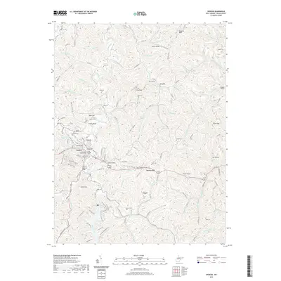
2019 Map of Spencer
USGS Topo · Published 2019About this map
The Roane County Courthouse serves as the focal point of the county seat in this 2019 survey, where the town of Spencer is deeply integrated into the winding valley of Spring Creek. The landscape is defined by its complex network of named runs and hollows, such as Blosser Hollow and Steele Hollow, which reveal a long history of local land ownership and family-named terrain. Higher elevations like Turkey Knob and College Hill overlook the intersection of critical regional routes, including US RTE 119 and WV RTE 33.
Find a feature on this map
144 named features on this map. Tap any name to fly to it.
Don’t see what you’re looking for? This feature index may not catch every label — zoom into the map to look around manually.
Map Details
Editions of this 2019 Spencer Map
This is the sole edition of this map. No revisions or reprints were ever made.
Other maps of this area

1906 · Otter
USGS Topo · 1:62,500

1906 · Walton
USGS Topo · 1:62,500

1907 · Otter
USGS Topo · 1:62,500

1907 · Arnoldsburg
USGS Topo · 1:62,500

1907 · Spencer
USGS Topo · 1:62,500

1907 · Walton
USGS Topo · 1:62,500

1925 · Arnoldsburg
USGS Topo · 1:62,500

1927 · Arnoldsburg
USGS Topo · 1:62,500

1928 · Spencer
USGS Topo · 1:62,500

1954 · Charleston
USGS Topo · 1:250,000