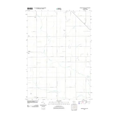
2010 Map of Spencer South
USGS Topo · Published 2010About this map
The Yellow River and its various tributaries wind through this section of Marathon County, defining a landscape traditionally rooted in the agricultural and dairy heritage of central Wisconsin. Small rural communities like Chili and Veefkind serve as local anchors, connected by a systematic grid of county highways and named township roads such as Lincoln Spencer RD. For those researching local lineages, the map identifies three significant burial grounds: Coles Cemetery in the north, Salem Cemetery to the west, and Veefkind Cemetery near its namesake settlement. The hydrography is particularly detailed, tracing the courses of the East Branch Yellow River and South Branch Yellow River as they meander through the woodlots and fields, illustrating the drainage patterns that have shaped the land use and farm boundaries of the region for generations.
Find a feature on this map
40 named features on this map. Tap any name to fly to it.
Don’t see what you’re looking for? This feature index may not catch every label — zoom into the map to look around manually.
Map Details
Editions of this 2010 Spencer South Map
This is the sole edition of this map. No revisions or reprints were ever made.
Other maps of this area

1902 · Marathon
USGS Topo · 1:125,000

1953 · Abbotsford
USGS Topo · 1:48,000

1953 · Stratford
USGS Topo · 1:48,000

1953 · Eau Claire
USGS Topo · 1:250,000

1954 · Granton
USGS Topo · 1:62,500

1954 · Marshfield
USGS Topo · 1:62,500

1958 · Eau Claire
USGS Topo · 1:250,000

1963 · Stratford
USGS Topo · 1:62,500

1963 · Abbotsford
USGS Topo · 1:62,500

1964 · Eau Claire
USGS Topo · 1:250,000