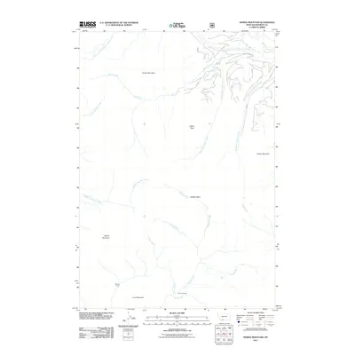
2011 Map of Sphinx Mountain
USGS Topo · Published 2011About this map
Sphinx Mountain and Pioneer Mountain dominate this high-elevation landscape in Madison County, where numerous drainages carve through the Madison Range. The drainage patterns revealed here show a complex watershed including the South Fork West Fork Gallatin River in the north and the southward-flowing Indian Creek. Remote outposts such as Manley Camp and Indian Crossing provide evidence of human activity in an area otherwise defined by its sharp peaks and deep basins, such as McAtee Basin. A network of Forest Service routes, including FS 531 and FS 325, snakes through the eastern portion of the quadrangle, primarily following the courses of Second Yellow Mule Creek and Third Yellow Mule Creek. Notable landmarks like Eglise Rock and Flattop Mountain serve as distinctive navigational points within this wilderness, which remained largely undeveloped well into the early 21st century.
Find a feature on this map
30 named features on this map. Tap any name to fly to it.
Don’t see what you’re looking for? This feature index may not catch every label — zoom into the map to look around manually.
Map Details
Editions of this 2011 Sphinx Mountain Map
This is the sole edition of this map. No revisions or reprints were ever made.
Other maps of this area

1888 · Three Forks
USGS Topo · 1:250,000

1894 · Three Forks
USGS Topo · 1:250,000

1895 · Three Forks
USGS Topo · 1:250,000

1947 · Bozeman
USGS Topo · 1:250,000

1948 · Bozeman
USGS Topo · 1:250,000

1949 · Ennis
USGS Topo · 1:62,500

1950 · Cameron
USGS Topo · 1:62,500

1950 · Spanish Peaks
USGS Topo · 1:62,500

1950 · Sphinx Mountain
USGS Topo · 1:62,500

1955 · Bozeman
USGS Topo · 1:250,000