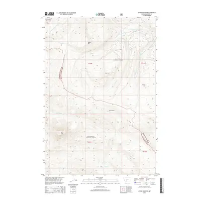
2014 Map of Sphinx Mountain
USGS Topo · Published 2014About this map
Sphinx Mtn and Pioneer Mtn dominate this high-altitude landscape within the Beaverhead National Forest and Gallatin National Forest. This section of the Madison Range shows a complex drainage network where the S Fork W Fork Gallatin River and Third Yellow Mule Cr originate. The presence of Indian Crossing at Indian Cr suggests historical travel routes through these peaks long before modern surveying. Geologic and topographic landmarks like Eglise Rock and the broad McAtee Basin define the high country, while numerous smaller drainages including McAtee Cr, Gorge Cr, and Cougar Cr carve the terrain. This map documents a wilderness area where human imprint is limited to a few named crossings and access points amidst significant summits like Flattop Mtn and Circle Mtn.
Find a feature on this map
31 named features on this map. Tap any name to fly to it.
Don’t see what you’re looking for? This feature index may not catch every label — zoom into the map to look around manually.
Map Details
Editions of this 2014 Sphinx Mountain Map
This is the sole edition of this map. No revisions or reprints were ever made.
Other maps of this area

1888 · Three Forks
USGS Topo · 1:250,000

1894 · Three Forks
USGS Topo · 1:250,000

1895 · Three Forks
USGS Topo · 1:250,000

1947 · Bozeman
USGS Topo · 1:250,000

1948 · Bozeman
USGS Topo · 1:250,000

1949 · Ennis
USGS Topo · 1:62,500

1950 · Cameron
USGS Topo · 1:62,500

1950 · Spanish Peaks
USGS Topo · 1:62,500

1950 · Sphinx Mountain
USGS Topo · 1:62,500

1955 · Bozeman
USGS Topo · 1:250,000