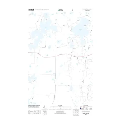
2013 Map of Spider Lake
USGS Topo · Published 2013About this map
The glaciated geography of Sawyer County is defined by an intricate network of interconnected waterways, most notably the expansive Spider Lake and Lost Land Lake. This 2013 survey illustrates a landscape dominated by timber and tourism, where numerous smaller basins like One Shoe Lake, Whiplash Lake, and Little Ole Lake are linked by minor drainages. The southern portion of the map is shaped by the Tiger Cat Flowage, a man-made impoundment that altered the original flow of the Dead Cr. Transportation in this lake-dense region is restricted to a few key arteries, including W State Road 77 and N County Hwy-A, which navigate around the wetland margins and spring-fed basins like Dead Creek Spring. Local history is reflected in several family-named landmarks and camps, such as Davies Lake and Camp Four Lakes, indicating the area's long-standing use for recreation and forestry.
Find a feature on this map
73 named features on this map. Tap any name to fly to it.
Don’t see what you’re looking for? This feature index may not catch every label — zoom into the map to look around manually.
Map Details
Editions of this 2013 Spider Lake Map
This is the sole edition of this map. No revisions or reprints were ever made.
Other maps of this area

1943 · Namekagon Lake
USGS Topo · 1:48,000

1944 · Couderay
USGS Topo · 1:48,000

1944 · Radisson
USGS Topo · 1:48,000

1944 · Hayward
USGS Topo · 1:48,000

1945 · Namekagon Lake
USGS Topo · 1:48,000

1948 · Couderay
USGS Topo · 1:48,000

1949 · Radisson
USGS Topo · 1:48,000

1953 · Ashland
USGS Topo · 1:250,000

1953 · Rice Lake
USGS Topo · 1:250,000

1958 · Ashland
USGS Topo · 1:250,000