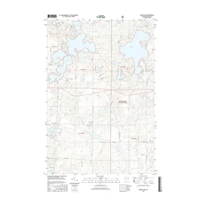
2015 Map of Spider Lake
USGS Topo · Published 2015About this map
Chequamegon National Forest dominates this northern Wisconsin landscape, where a dense network of glacial lakes and waterways defines the regional character. Large bodies of water like Spider Lake and Lost Land Lake are central features, surrounded by smaller, uniquely named basins such as One Shoe Lake, Sickles Lake, and Whiplash Lake. This area of Sawyer County is characterized by a mix of established routes like State Hwy 77 and primitive tracks including W Boys Camp Rd and various Forest Service roads. The presence of Dead Creek Spring and the Tiger Cat Flowage reflects the complex hydrography of the Upper Chippewa River basin. Historically significant for its timber and recreation, the map details the intricate shoreline of Mukwonago Lake and the wetlands around Camp Four Lakes, providing a clear record of the Northwoods geography in the early twenty-first century.
Find a feature on this map
77 named features on this map. Tap any name to fly to it.
Don’t see what you’re looking for? This feature index may not catch every label — zoom into the map to look around manually.
Map Details
Editions of this 2015 Spider Lake Map
This is the sole edition of this map. No revisions or reprints were ever made.
Other maps of this area

1943 · Namekagon Lake
USGS Topo · 1:48,000

1944 · Couderay
USGS Topo · 1:48,000

1944 · Radisson
USGS Topo · 1:48,000

1944 · Hayward
USGS Topo · 1:48,000

1945 · Namekagon Lake
USGS Topo · 1:48,000

1948 · Couderay
USGS Topo · 1:48,000

1949 · Radisson
USGS Topo · 1:48,000

1953 · Ashland
USGS Topo · 1:250,000

1953 · Rice Lake
USGS Topo · 1:250,000

1958 · Ashland
USGS Topo · 1:250,000