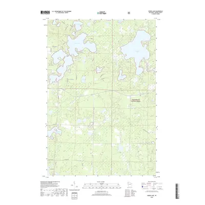
2018 Map of Spider Lake
USGS Topo · Published 2018About this map
Spider Lake and Lost Land Lake anchor this Sawyer County landscape, where glacial depressions have created a dense concentration of water bodies. The northern half of the map is defined by an intricate network of shorelines, featuring islands and narrow channels like those found in North Lake and Eagle Nest Lake. This area shows a established pattern of lakeside access via roads such as Hahns Rd and N Balsam Rd, while the southern reaches transition into the protected timberlands of the Chequamegon National Forest.
Find a feature on this map
54 named features on this map. Tap any name to fly to it.
Don’t see what you’re looking for? This feature index may not catch every label — zoom into the map to look around manually.
Map Details
Editions of this 2018 Spider Lake Map
This is the sole edition of this map. No revisions or reprints were ever made.
Other maps of this area

1943 · Namekagon Lake
USGS Topo · 1:48,000

1944 · Couderay
USGS Topo · 1:48,000

1944 · Radisson
USGS Topo · 1:48,000

1944 · Hayward
USGS Topo · 1:48,000

1945 · Namekagon Lake
USGS Topo · 1:48,000

1948 · Couderay
USGS Topo · 1:48,000

1949 · Radisson
USGS Topo · 1:48,000

1953 · Ashland
USGS Topo · 1:250,000

1953 · Rice Lake
USGS Topo · 1:250,000

1958 · Ashland
USGS Topo · 1:250,000