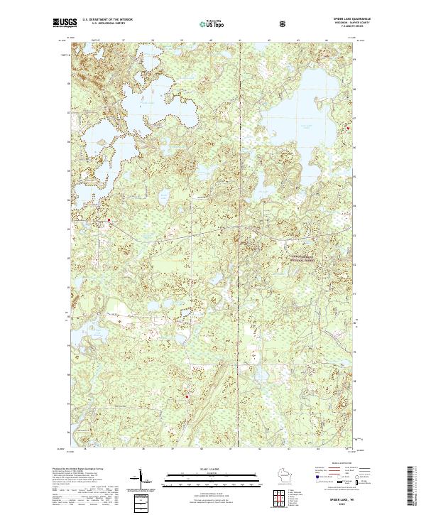
2022 Map of Spider Lake
USGS Topo · Published 2022About this map
Spider Lake and the surrounding Northwoods landscape of Sawyer County define this region within the Chequamegon National Forest. The map reveals a complex network of glacial water bodies, from the sprawling reach of Lost Land Lake to smaller, isolated features like Whiplash Lake, Eagle Nest Lake, and Sickles Lake. Human development is concentrated along the shorelines, where residential access roads like Moonamaniis Rd, N Balsam Rd, and W Boys Camp Rd navigate the irregular peninsulas and coves.
Find a feature on this map
62 named features on this map. Tap any name to fly to it.
Don’t see what you’re looking for? This feature index may not catch every label — zoom into the map to look around manually.
Map Details
Editions of this 2022 Spider Lake Map
This is the sole edition of this map. No revisions or reprints were ever made.
Other maps of this area

1943 · Namekagon Lake
USGS Topo · 1:48,000

1944 · Couderay
USGS Topo · 1:48,000

1944 · Radisson
USGS Topo · 1:48,000

1944 · Hayward
USGS Topo · 1:48,000

1945 · Namekagon Lake
USGS Topo · 1:48,000

1948 · Couderay
USGS Topo · 1:48,000

1949 · Radisson
USGS Topo · 1:48,000

1953 · Ashland
USGS Topo · 1:250,000

1953 · Rice Lake
USGS Topo · 1:250,000

1958 · Ashland
USGS Topo · 1:250,000