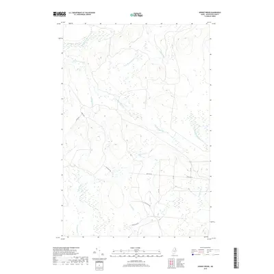
2018 Map of Spinney Brook
USGS Topo · Published 2018About this map
North Branch Blackwater River and its southern counterpart, the S Br Blackwater River, dominate this pocket of Aroostook County, Maine. The landscape is defined by an intricate network of waterways draining toward the east, including Spinney Brook, Beaver Brook, and the West Branch Presque Isle Stream. This region of T9 R4 WELS remains largely undeveloped, characterized by timber management and recreation rather than traditional township centers.
Find a feature on this map
18 named features on this map. Tap any name to fly to it.
Don’t see what you’re looking for? This feature index may not catch every label — zoom into the map to look around manually.
Map Details
Editions of this 2018 Spinney Brook Map
This is the sole edition of this map. No revisions or reprints were ever made.
Other maps of this area

1931 · Ashland
USGS Topo · 1:48,000

1934 · Ashland
USGS Topo · 1:62,500

1935 · Howe Brook
USGS Topo · 1:48,000

1935 · Presque Isle
USGS Topo · 1:62,500

1939 · Howe Brook
USGS Topo · 1:62,500

1940 · Oxbow
USGS Topo · 1:62,500

1942 · Oxbow
USGS Topo · 1:62,500

1953 · Ashland
USGS Topo · 1:62,500

1953 · Presque Isle
USGS Topo · 1:62,500

1954 · Howe Brook
USGS Topo · 1:62,500