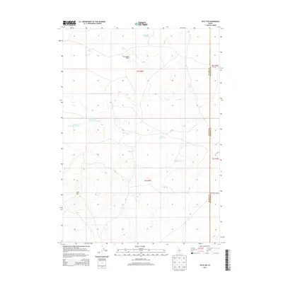
2013 Map of Split Top
USGS Topo · Published 2013About this map
The high desert landscape of Blaine and Bingham counties is defined by a complex system of surface water and volcanic topography. Dominating the southern terrain, Split Top rises as a prominent landmark near the boundary line, while Packsaddle Butte anchors the northern portion of the quadrangle. This 2013 survey illustrates a region where water management is critical, evidenced by the presence of Clear Lake Reservoir and the dual basins of Houghland Reservoir Number 1 and Houghland Reservoir Number 2.
Find a feature on this map
18 named features on this map. Tap any name to fly to it.
Don’t see what you’re looking for? This feature index may not catch every label — zoom into the map to look around manually.
Map Details
Editions of this 2013 Split Top Map
This is the sole edition of this map. No revisions or reprints were ever made.
Other maps of this area

1955 · Idaho Falls
USGS Topo · 1:250,000

1958 · Idaho Falls
USGS Topo · 1:250,000

1972 · Antelope Lake
USGS Topo · 1:24,000

1972 · Split Top
USGS Topo · 1:24,000

1972 · Mosby Well
USGS Topo · 1:24,000

1972 · Mosby Butte
USGS Topo · 1:24,000

1972 · Sunset Lake
USGS Topo · 1:24,000

1972 · Serviceberry Butte
USGS Topo · 1:24,000

1973 · Rock Butte
USGS Topo · 1:24,000
1973 · Coffee Point SW
USGS Topo · 1:24,000