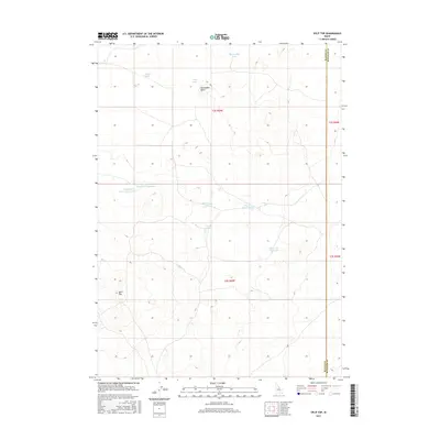
2017 Map of Split Top
USGS Topo · Published 2017About this map
Split Top rises as a prominent landmark in this high-desert landscape along the border of Bingham and Blaine Counties. This 2017 survey by the U.S. Geological Survey documents a region defined by scattered water sources and reservoirs essential for land management. Notable water features include the Clear Lake Reservoir and the twin Houghland Reservoir Number 1 and Houghland Reservoir Number 2 to the northwest. The terrain is punctuated by significant volcanic or erosional features like Packsaddle Butte, while smaller water bodies such as Packsaddle Lake, Wild Horse Lake, and Gentle Horse Lake are distributed across the high plains. The map's detail provides a clear view of the complex hydrography and public land survey system divisions that govern this section of Idaho.
Find a feature on this map
16 named features on this map. Tap any name to fly to it.
Don’t see what you’re looking for? This feature index may not catch every label — zoom into the map to look around manually.
Map Details
Editions of this 2017 Split Top Map
This is the sole edition of this map. No revisions or reprints were ever made.
Other maps of this area

1955 · Idaho Falls
USGS Topo · 1:250,000

1958 · Idaho Falls
USGS Topo · 1:250,000

1972 · Antelope Lake
USGS Topo · 1:24,000

1972 · Split Top
USGS Topo · 1:24,000

1972 · Mosby Well
USGS Topo · 1:24,000

1972 · Mosby Butte
USGS Topo · 1:24,000

1972 · Sunset Lake
USGS Topo · 1:24,000

1972 · Serviceberry Butte
USGS Topo · 1:24,000

1973 · Rock Butte
USGS Topo · 1:24,000
1973 · Coffee Point SW
USGS Topo · 1:24,000