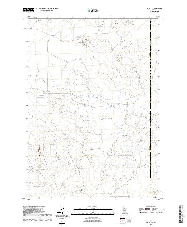
2023 Map of Split Top
USGS Topo · Published 2023About this map
Split Top and Packsaddle Butte anchor this high-desert landscape in eastern Blaine County, where water management is the primary human imprint on the terrain. The survey reveals a network of isolated basins and artificial storage, including the Houghland Reservoir Number 1 and Houghland Reservoir Number 2, which serve the arid range. These features, along with Clear Lake Reservoir to the southeast, highlight the critical nature of water storage for local ranching or agricultural needs in this part of Idaho. Scattered natural catchments like Wild Horse Lake, Gentle Horse Lake, and Binder Lake dot the township divisions, illustrating the characteristic hydrology of the high plains where small, often seasonal bodies of water are the only breaks in the expansive topography. The map also delineates the jurisdictional boundary where Blaine meets Bingham County.
Find a feature on this map
16 named features on this map. Tap any name to fly to it.
Don’t see what you’re looking for? This feature index may not catch every label — zoom into the map to look around manually.
Map Details
Editions of this 2023 Split Top Map
This is the sole edition of this map. No revisions or reprints were ever made.
Other maps of this area

1955 · Idaho Falls
USGS Topo · 1:250,000

1958 · Idaho Falls
USGS Topo · 1:250,000

1972 · Antelope Lake
USGS Topo · 1:24,000

1972 · Split Top
USGS Topo · 1:24,000

1972 · Mosby Well
USGS Topo · 1:24,000

1972 · Mosby Butte
USGS Topo · 1:24,000

1972 · Sunset Lake
USGS Topo · 1:24,000

1972 · Serviceberry Butte
USGS Topo · 1:24,000

1973 · Rock Butte
USGS Topo · 1:24,000
1973 · Coffee Point SW
USGS Topo · 1:24,000